🌎 Get ready with me: Government grants edition 💅💵
A founder’s guide to winning non-dilutive funding with Elemental Excelerator
This week, we chatted with Indra den Bakker, who has developed a vegetation intelligence platform helping electric utilities, forestry companies, and NGOs mitigate wildfires and power outages.

Indra den Bakker, Founder and CEO of Overstory
This week, we chatted with Indra den Bakker, who has developed a vegetation intelligence platform helping electric utilities, forestry companies, and NGOs mitigate wildfires and power outages. Overstory is an Amsterdam-based company that leverages machine-learning and satellite technology to identify areas of greatest wildfire risk, a task which up until now has been performed manually.
How does Overstory help prevent wildfires? How important is vegetation management to preventing wildfires?
When we started we focused more on forests in general and were not necessarily thinking about wildfires. What we’ve learned over the years from utilities is that this connection between trees and powerlines is one of the major causes of fires, not only in California, but in places like southern Europe. As the climate changes, more areas are becoming susceptible to fires.
We found out that utility firms are spending hundreds of thousands of dollars per year on vegetation management – using helicopters, drones, and other aerial mechanisms to monitor their sites. With these practices it can take utilities multiple years to scan their whole network just once because a network is often tens of thousands of miles,spread out across states and remote forests.
With our technology, we’re able to do that same monitoring in one day – a massive increase in site revisitry. The frequency of tree and other vegetation monitoring is important because trees are growing and conditions can change day by day Vegetation growth, decreasing tree vitality impacting the stability of a tree, drought of the vegetation. Especially with the changing climate – and more severe weather circumstances such as drought and storms – an up to date view is needed to inform preventive action. . By providing more detailed information, we help our customers do more targeted vegetation management and help them understand current and future risks.
We have different types of customers including corporate players, NGOs, reinsurers, and utilities. For all of them, we are focused on providing more transparent, detailed, and actionable data to improve decision-making on forests and trees.
What are the solutions utilities are using now for monitoring forests and managing risks?
It depends on the size of the utility. That is why the US is interesting. There are large investor-owned utilities and small, often city-based, utilities. You’ll be surprised to hear that most utilities go out by foot to manually monitor and manage vegetation near power lines. Bigger utility companies might have their own helicopters and drones, but that is still not efficient or scalable because networks on the grid are so large. They are using technology but it does not solve their problems yet, which is why our solution is so interesting to them. It offers a new dimension of efficiency and insight.
What we also see in California more frequently are “public safety power shut-off”. When a combination of dry vegetation, hot weather and high winds there is an increased risk for electrical-system damage that could ignite fires.
Where do the inputs come from? Where are the satellite imagery data sources from?
Satellite imagery is our main data source. We have partnered with all major providers in the space like Maxar, Planet, and Airbus. They all have their own specialty. We extract value from those images to make them actionable for utilities.
More and more satellites are being launched today since it is getting cheaper to do so. More players, therefore, are likely to join.
What are the potential cost-savings from using Overstory for monitoring compared to other options?
On one side, it is on more-targeted maintenance of the vegetation – saving utilities 10-20%. More importantly, we can help prevent outages, improve reliability and limit liability, which is supporting a different level of savings, by facilitating management that mitigates extreme events. Everyone knows what happened with PG&E, and people do not want that to happen again.
Utilities are preparing for the changing climate. It is not just about the money they can save now but also the money in the future by preventing larger events, and of course the consequences on the planet and society that comes with it.
Every year, we set a new record for wildfires. What do you think is going to happen in the coming decades to create better management solutions?
I think management will be a big challenge. Our solution won’t help prevent all fires. We try to focus on sharing better data to guide decisions and insights – how to manage the forest, where the fuel for forest fires comes from, how the fires spread, how to keep communities safe.
There is still a lot of data missing. This is where we can add value, but the problem is complex and climate is changing so rapidly that we will need to collaborate with other actors to be more effective. Overstory and the data it provides are just one piece of the puzzle.
What do you do to make the data you provide actionable?
With the utilities, it is more about where do we see immediate and future risk. We extract the vegetation species and how fast they grow to the tree variety and whether they’re healthy. Those are all things that can help to manage future risk.
We also work with the forest industry to help them better understand how to maintain their forests and make them more sustainable. In California, factors of influence were the lack of sustainable forest management and unknowns about fuel load combined with drought that caused the recent wildfires to spread. Understanding these patterns is where Overstory can be helpful.
What are the health factors you use to assess wildfire risk?
For immediate risk, it is mostly about how close the vegetation is to powerlines. For future risk, we are able to use our knowledge of species to project how they will evolve in the region. Long-term risk has to do more with the health of the trees and wind speeds we can expect. It is all risk-based, which is not 100% accurate, but allows utilities to plan ahead.
For example, if we see that there is an insect outbreak at a distance of the powerline, we still know it can impact trees closer to the power lines. We try to make our data more predictive for the customer.
Given your in-depth understanding of vegetation, are there customers beyond utilities interested in your services?
Local landowners in general and reinsurers are some other groups interested in our product. In western California, for example, it is top-of-mind for many people and organizations because of how they are severely impacted by wildfires.
Overall, do you see enough innovation happening at the early stage climate tech side to make a dent on wildfires?
I think there is a lot happening. The recent fires in the US, Brazil, and Siberia this year and the last few years show that there needs to be more focus on this issue.
There is a lot of innovation happening, and there is not one solution that can fix everything. For example, there are other solutions that use drones to fight fires – which can be another part of the solution. There is no one-fits-all solution.
What are other core areas, beyond prevention/mitigation, that are important to limiting wildfires?
Cutting down emissions generally will help. I think it also important to learn from local people who have been on the ground for a long time. That part of the wildfire equation has been forgotten by many. We can see a lot with satellite imagery but local people know their forests better on a micro-level. A lot of research also needs to be done to answer questions like, “Why are fires worsening in certain areas?”
Since you understand this vegetation so well, have you considered adjacent business models like accounting for carbon sequestration within organic matter?
We do that for some customers. However, that is not our main focus. We know how much carbon is sequestered by determining the species, the biomass along with how it grows and where it’s located. That is another application and shows that satellite imagery can work at the global scale and provide unbiased data-driven insights. It’s an important tool for the carbon markets to make it more transparent.
Interested in joining Overstory? They’re looking to hire a US-based Business Development Manager
Interested in more content like this? Subscribe to our weekly newsletter on Climate Tech below!
A founder’s guide to winning non-dilutive funding with Elemental Excelerator

Infrastructure investing for impact with Banyan Infrastructure's Amanda Li
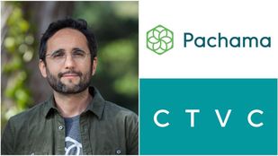
Venturing into nature with Diego Saez-Gil at Pachama
 Founders